The South Island and lower North Island are in for a thrashing of strong winds as ex-tropical cyclone Uesi passes over the bottom of the country.
Uesi is forecast to hit New Zealand tomorrow night before settling in near Fiordland on Sunday.
Severe north to nothwesterly gales are expected for the bottom half of the country throughout Sunday and Monday
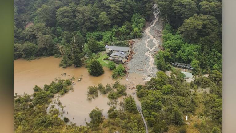
More rain is expected over the South Island, adding to the huge dumping which flooded the West Coast and Southland last week.
Extreme weather caused slips and washed out roads, flooding parts of the West Coast and Southland.
Last week's storm has forced State Highway 94, Milford Road to close temporarily with repairs expected to take more than a year to completely fix the road according to a statement from NZTA.
A heavy rain watch is currently enforced for Westland south of Otira with rain warnings for Westland ranges, Fiordland, Buller ranges as well as headwaters of Otago and Canterbury lakes and rivers.
Up to 250mm of rain is forecast to accumulate in the Westland ranges with another possible maximum rainfall of 100mm near the coast on Sunday as the storm settles in.


SHARE ME